Among those involved in remaking the Mississippi was a Germanborn mapmaker, Henry Peter Bosse. Coming to America in 1870, the twenty-six-years-old immigrant joined the Corps four years later and was sent to draw the river from St. Paul, Minnesota to St. Louis, Missouri. But the draftsman did more; he took at least 350 large format photographs between 1883-93, as he worked his way 729 miles downstream from the upper limit of navigation.
“U.S. Agriculture depends utterly on a viable transportation network to enable farmers to access the world markets. We produce far more commodities such as corn than we could ever hope to consume domestically, and the competition from the export market forces domestic users to bid competitively for those commodities, keeping prices above the cost of production.
Water transportation moves 16% of our nation’s freight for 2% of the freight cost. Compared to alternative modes, barges save shippers and consumers more than $7 billion annually.
One gallon of fuel can move one ton of cargo 522 miles by barge, 386 miles by rail and 59 miles by truck.
Take a dam tour.
Watch the dam cam.
The Mississippi River Basin is made up of several Subbasins.
Map of Iowa’s locks and dams along the Upper Mississippi.
This photo was taken moderately high.
This photo was taken dam high.
More dam photos.
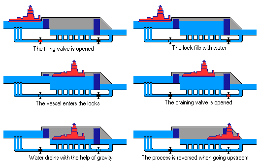
The dams do not control floods; during high water, the dam gates are raised out of the water. Below St. Louis, the river is deep enough so that locks and dams are not needed for commercial navigation.
In general, dams transform rivers into lakes and impoundments. The resulting changes in water depth, water currents, temperature, and restructured fish and algal communities can negatively affect freshwater mussels.

